|
| *****SWAAG_ID***** | 685 |
| Date Entered | 20/02/2013 |
| Updated on | 02/04/2016 |
| Recorded by | Tim Laurie |
| Category | Mining Related |
| Record Type | Mining |
| SWAAG Site | Skelton Moor - Cock How area, East of Helwith Road |
| Site Access | Public Access Land |
| Record Date | 17/02/2013 |
| Location | Prys House to Munn End, Greengate Flots |
| Civil Parish | Marske |
| Brit. National Grid | NZ 0750 0225 |
| Altitude | 344m |
| Geology | The Main Limestone. |
| Record Name | Greengates Flots. Early surface mine activity associated with the Shaw Vein |
| Record Description | Extensive linear area of small surface mine working pits on lead ore-rich flatts and the mineralised vertical fractures of the Main Limestone (scrins). The surface mining averages 100m in width over a distance of not less than 1km, from Munn End Gate westward to the Prys House Mine. These surface workings on readily accessible lead deposits could represent the earliest lead mining activity in the Yorkshire Dales. The presence of a rectangular platform settlement with early pottery sherds located adjacent to and convenient to exploit the Greengates Flots mining ground would seem to confirm early mining activity here.
Occasional shaft mounds and a Level here indicate scattered mining subsequent to the early surface workings.
Reference: Dunham, K.C. and Wilson, A.A.1985. 'Geology of the North pennine Orefield. Volume 2. Stainmore to Craven. Chapter 9 and Figures 25 and 27.' British Geological Survey. |
| Dimensions | See photos |
| Image 1 ID | 4015 Click image to enlarge |
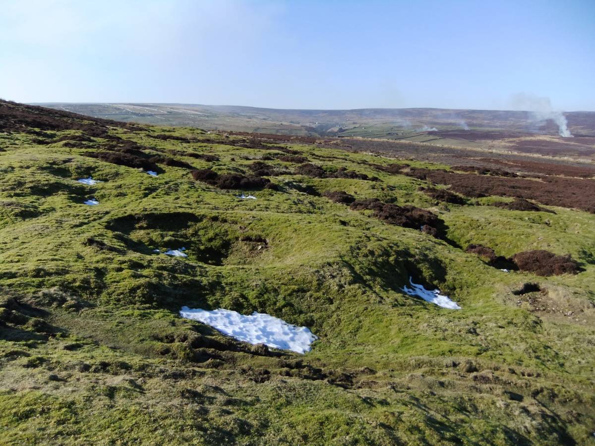
| Image 1 Description | Greengate Flots. an area of early surface lead mine workings. | 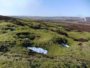 |
| Image 2 ID | 4016 Click image to enlarge |
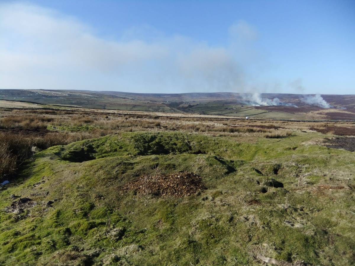
| Image 2 Description | Greengate Flots. Shaft mounds, later and deeper mine working within an area of early surface lead mine workings. | 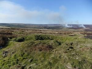 |
| Image 3 ID | 4017 Click image to enlarge |
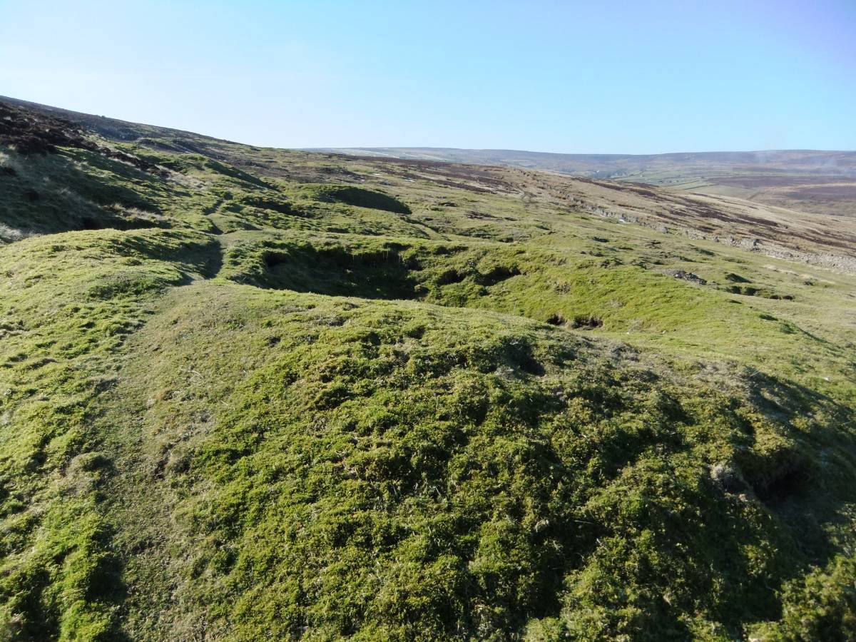
| Image 3 Description | Greengate Flots. Two shaft mounds near Munn End Gate, later deeper mines within an area of early surface lead mine workings. | 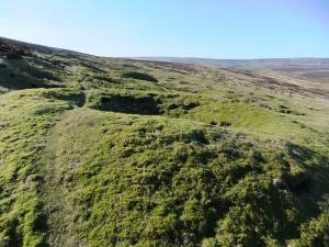 |
| Image 4 ID | 4018 Click image to enlarge |
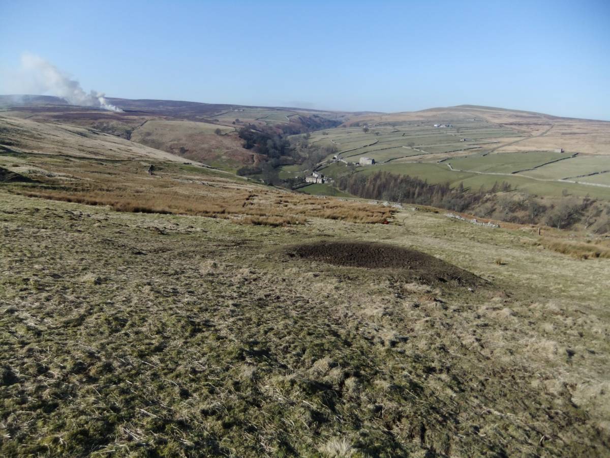
| Image 4 Description | Greengate Flots an early surface pit below Munn End Gate | 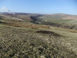 |
| Image 5 ID | 4019 Click image to enlarge |
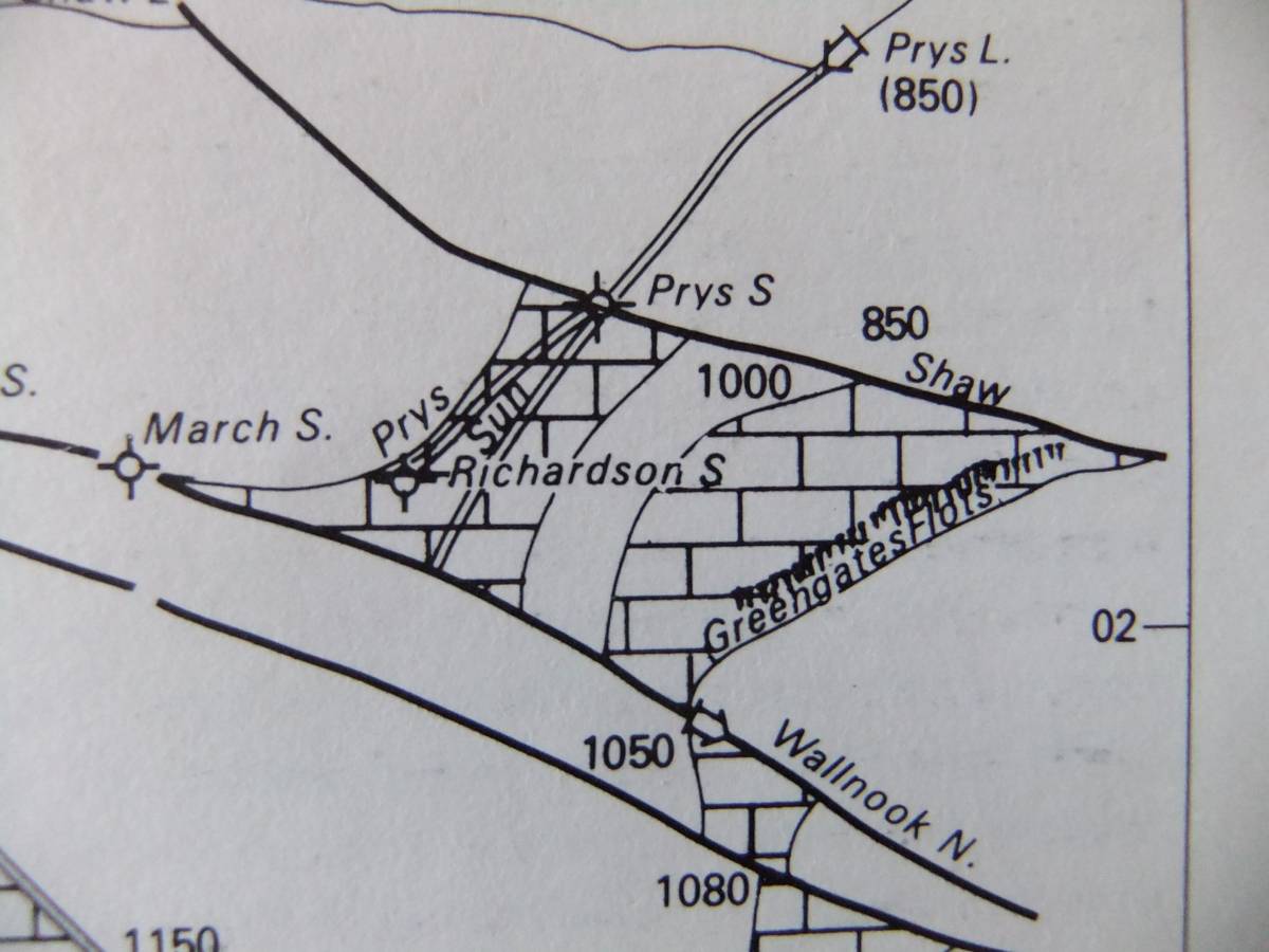
| Image 5 Description | Location of the Greengate Flots in relation to the Shaw Vein and Prys Mines. Extract from Dunham and Wilson 1985, Figure 27. | 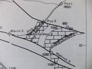 |
| Image 6 ID | 4020 Click image to enlarge |
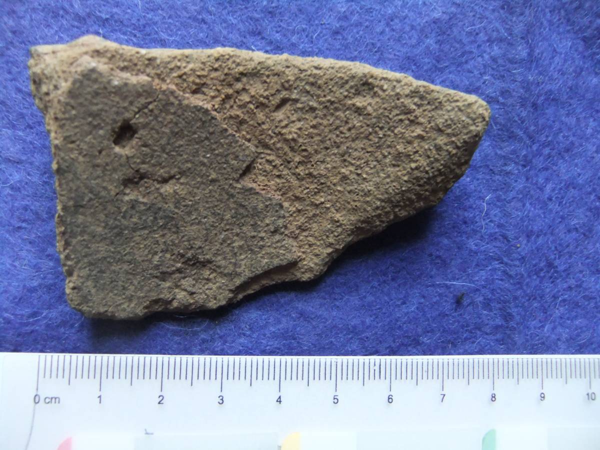
| Image 6 Description | Early pottery sherd found at an adjacent settlement site. | 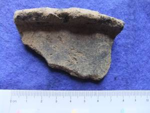 |
| Image 7 ID | 4021 Click image to enlarge |
| Image 7 Description | Early pottery sherd found at an adjacent settlement site. |  |